 Only
on Outdoors Niagara - An
Outdoors Niagara Exclusive!
Only
on Outdoors Niagara - An
Outdoors Niagara Exclusive!HomeOnly
on Outdoors Niagara - An
Outdoors Niagara Exclusive!
Back to Home Back to Hilts Fish Locator / Upper Niagara River Map & Info / Back to Outdoor Forum
|
|
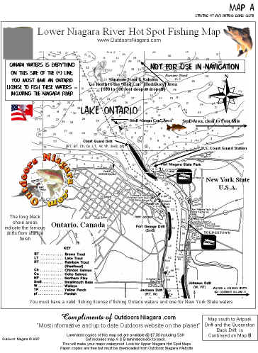
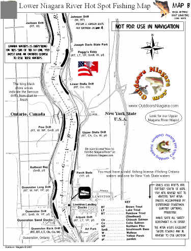
Lower
Niagara River maps 
Fish Where The Fish Are!
To print these maps go to the PDF version and you will get a great - clear picture. 1 page per side print
|
Click Here Map A For Your Printing FREE
|
Click Here Map B For Your Printing You can enlarge these pictures but for a super view, see them in PDF form. You can print from there. FREE. |
Outdoors Niagara River Fishing Maps ~ Fish Where The Fish Are!
|
Upper Niagara River fishing information and a good hand drawn map complete with accepted trolling patterns and fish species locations HERE |
GO HERE FOR BEST CALENDAR TIMES TO FISH FOR YOUR SPECIES / Fishing Tips Here
Back to Home / Back to Hilts Fish Locator / Back to Joe Ognibene Weekly / Back to Outdoor Forum